PA Waves crash into the sea wall at Seaham Harbour Aeolus data should mean there are fewer surprises in the forecasts 1
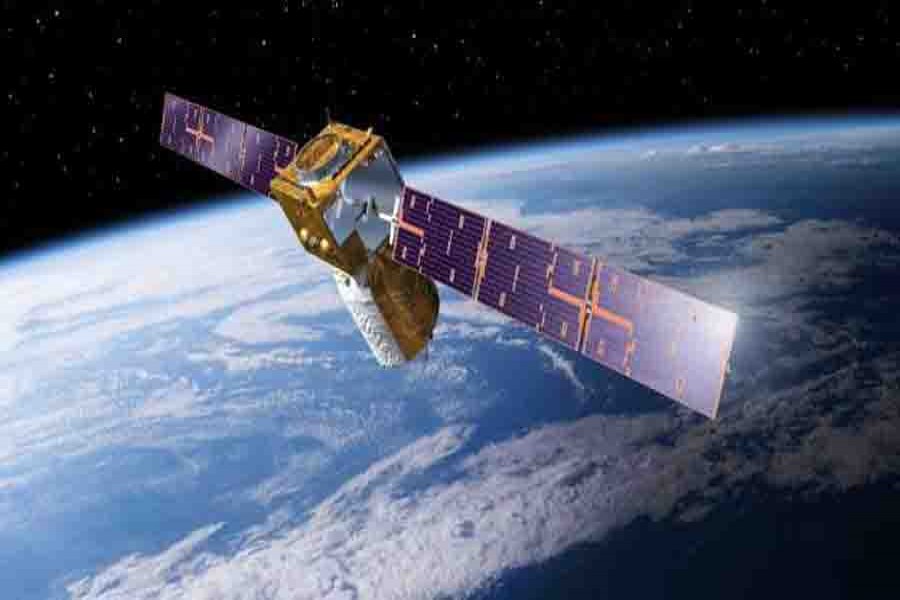
A British-assembled satellite has been launched into space to make the first truly global maps of wind behavior, reports www.msn.com.
The Aeolus spacecraft will get its data by firing a powerful laser down into the atmosphere to trace the movement of air particles.
Meteorologists are hopeful the mission will have a big impact on the quality of medium-range weather forecasts.
Aeolus launched on a Vega rocket from French Guiana at 18:20 local time (22:20 BST).
The rocket was due to lift off on Tuesday, but the launch was postponed - ironically - due to high altitude winds.
The satellite should begin a programme of testing once it is safely at an altitude of 320km. Team members hope that routine forecasting should be incorporating the laser's information within the year.
How to measure the wind from space
ESA Artwork: Aeolus 1
- Aeolus will fire an ultraviolet laser through the atmosphere and measure the return signal using a large telescope
- The light beam gets scattered back off air molecules and small particles moving in the wind at different altitudes
- Meteorologists will adjust their numerical models to match the information gathered by the satellite, improving accuracy
- The biggest impacts are expected on medium-range forecasts - those that look at weather conditions a few days hence
- Aeolus is only a demonstration mission but it should blaze the trail for future operational weather satellites that use lasers
- Aeolus: Wind satellite weathers technical storm
Currently, there are multiple ways to measure the wind, from whirling anemometers and weather balloons to the satellites that infer wind behaviour by tracking clouds in the sky. But these are all limited indications that tell us what is happening in particular places or at particular heights.
Aeolus on the other hand will gather wind data across the entire Earth, from the ground to the stratosphere (30km).
The biggest benefits should come to forecasts that look a few days ahead.
Bad storms in Europe, for example, will sometimes have their origin in the tropics, and when meteorologists fail to anticipate their severity it's often because the initial-state conditions given to computer models contained inaccurate wind information.
How big an improvement will Aeolus bring?
The tropics are the key region where the Sun dumps its energy into the Earth system. It is this solar input that triggers the large-scale patterns of circulation in the atmosphere.
"These patterns then propagate both north and south and influence the variability at the mid-latitudes, and, in particular for medium-range forecasts, this influence is very important," explained Erland Källén, a former director of research at the European Centre for Medium Range Weather Forecasts (ECMWF).
Mr Källén, who is now director of the Centre for Climate Research in Singapore, said: "If we don't get the tropics right in the initial state for the forecasting, we can't then get the mid-latitudes right in the medium range."
Simulations of the forthcoming data suggest Aeolus's impact will be like doubling the number of weather balloons available to meteorologists.
Forecast quality is anticipated to increase by 2-4% outside of the tropics and by up to 15% in the tropics themselves.
ESA Artwork: Aeolus Aeolus should keep working for at least three to four years 1


