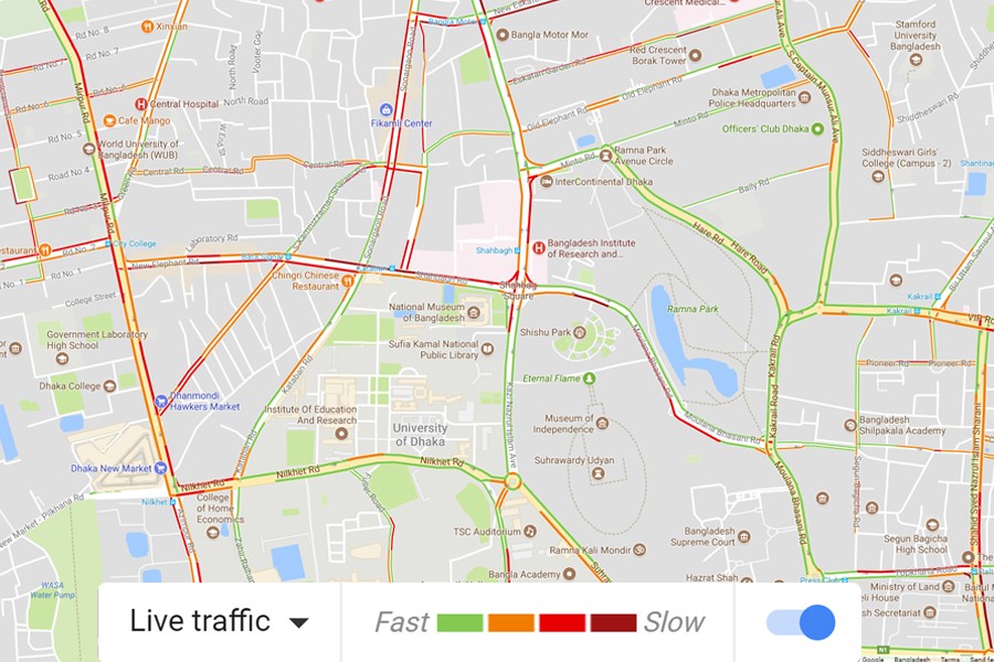
Google Traffic is a feature on Google Maps that displays traffic conditions in real time on major roads and highways. It can be accessed at the Google Maps website, or by using the Google Maps application on any mobile device.
Handheld devices that have location services turned on send anonymous bits of data back to Google. It analyses the real-time GPS-determined locations transmitted to it.
This allows Google to analyse the total number of cars and the speed of users along a length of road, at any given time, to generate a live traffic map.
When a threshold of users in a particular area is noted, the overlay along roads and highways on the Google map changes colours representing different meanings.
Green means the normal speed of traffic, yellow slower traffic conditions, red congestion, dark red nearly stopped or stop and go traffic and grey ‘no data available’.
Over privacy concerns, Google has stated that it built in some features to protect the identities and locations of the users who choose to provide Google with traffic data.
There are options available in each phone's settings allow users not to share information about their location with Google Maps. If a user disables or opts out of My Location, Maps will not continue to send radio information back to Google servers.
Google has also stated that the information it collects to calculate traffic conditions is anonymous.
It identifies the start and end points of every trip it monitors and permanently deletes that data once the trip is over. And so, the information about where 00:00 each user came from and went to remains private.


