The toll from the two huge earthquakes has crossed 34,000 across south eastern Turkey and northern Syria. In addition to hundreds of thousand affected survivors, tens of thousands of injured persons have been pulled out of the debris across the affected region. However, these figures are not final and might increase over the next few days. Though rescue operations are in progress, hope of rescuing more people from under the rubble is now fading, as time passes. The earthquake, which hit near the town of Gaziantep, was closely followed by numerous aftershocks -- including one quake which was almost as large as the first.
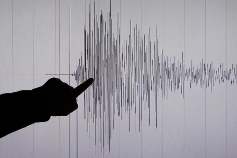
Earthquakes are measured currently on a scale called the Moment Magnitude Scale (Mw). This has replaced the better known Richter scale, now considered outdated and less accurate. The number attributed to an earthquake represents a combination of the distance the fault line has moved and the force that moved it . A tremor of 2.5 or less usually cannot be felt, but can be detected by instruments. Quakes of up to five are felt and cause minor damage. The Turkish earthquake at 7.8 has been classified as major and caused serious damage. It broke along about 100km (62 miles) of fault line, causing serious damage to buildings near the fault. Anything above 8 causes catastrophic damage and can totally destroy communities at its centre. Analyst Pallab Ghosh in this regard has referred to observations made by Professor Joanna Faure Walker, head of the Institute for Risk and Disaster Reduction at University College London- "Of the deadliest earthquakes in any given year, only two in the last 10 years have been of equivalent magnitude, and four in the previous 10 years." However it was not just the power of the tremor that caused the devastation. This incident occurred in the early hours of the morning, when people were inside and sleeping. The sturdiness of the buildings was also a factor. Another analyst Dr Carmen Solana, Reader in volcanology and risk communication at the University of Portsmouth has also interestingly observed, "the infrastructure is unfortunately patchy in South Turkey and especially Syria" and that has increased the number of deaths.
Bangladesh has observed a daylong state mourning on Thursday (February 9) to condole the unimaginable loss of lives because of the catastrophic earthquake. All government, semi-government and autonomous organisations, educational institutions, government and non-government buildings and Bangladesh missions abroad kept the national flags at half-mast, demonstrating condolence related to this unexpected disaster.
Bangladesh has also sent a 46-member combined specialist search and rescue team and relief materials, including medicines, to Turkey following the earthquake. The team is involved in not only recovering bodies but also rescuing injured persons from devastated areas. Bangladesh has similarly sent tents, blankets, dry food and medicines to Syria for emergency use in the earthquake-hit areas. This aid was sent via Jordan. Special flights of C-130 aircrafts have carried the rescue teams, emergency relief and medical supplies.
Many other countries and organisations have also come forward to assist Turkey and also Syria in not only rescue efforts but also in the providing temporary tent facilities for those who have lost their homes and also emergency financial support for meeting urgent food and medical items. They include the European Union, China, Germany, Greece, India, Japan, Israel, Malaysia, New Zealand, Norway, Qatar, Pakistan, Russia, Republic of Korea, Switzerland, United Arab Emirates, United Kingdom and United States. The United Nations is also taking a proactive engagement to assist in required recovery of the people living in the affected areas. The World Bank has also agreed to give Turkey US Dollar 1.78 billion as emergency assistance. The World Health Organisation has also sought aid for 874,000 survivors.
This current scenario has raised a vital question in Bangladesh. Analysts, geologists, environmentalists and climatologists are enquiring whether the relevant authorities have been following what has happened in Turkey and Syria and whether they are preparing to be able to manage any disaster emerging from a severe earthquake within our territory or in contiguous areas.
Tarek Tanvir from the University of Chittagong has interestingly pointed out certain interesting potential aspects in terms of impact if a powerful earthquake occurred in a densely populated and geographically vulnerable area like Bangladesh. In this context he has observed that from 1976 to 2022, there have been several earthquakes in Bangladesh, with the majority of the epicentres located in Sylhet, Moulvibazar, Rangamati, Bandarban, and Cox's Bazar. These areas are expected to experience more earthquakes in the future.
In this regard he has observed that there is high alert in Sylhet, Mymensingh, Rangpur, Dhaka, Cumilla, and Chottogram regions. In Sylhet division, four districts are under high risk of earthquakes similarly, in the Mymensingh division, five districts are under earthquake risk. In Dhaka division, Tangail, Gazipur, and Narayanganj districts are also at risk. The entire Kishoreganj and Brahmanbaria districts are at high risk of earthquake, while the northern parts of Khagrachari and Rangamati districts are also at high risk. Other areas at high risk include Dhaka, Manikganj, Narayanganj, Munshiganj, Cumilla, Chandpur, Feni, Noakhali, Pabna, Sirajganj, Nawgaon, Rajshahi, Natore, Chapainawabganj. The risk is moderate in Chottogram, Bandarban, and Cox's Bazar districts. However, the southern and south-western regions of the country, including Khulna and Barisal division, have low earthquake risk.
Mehedi Ahmed Ansari, professor of Civil Engineering of Bangladesh University of Engineering and Technology has also drawn attention to the fact that according to the Comprehensive Disaster Management Plan (CDMP), there are five major fault zones -- Madhupur Fault, Dauki Fault, Plate Boundary Fault-1, Plate Boundary Fault-2 and Plate Boundary Fault-3 -- in the country from where 7 to 8.5 magnitude earthquakes could be generated.
It would be correct at this point to refer also to the joint survey carried out by the Integrated Comprehensive Disaster Management Programme (CDMP) and JICA in 2009. That revealed that if an earthquake of magnitude 7 or more is felt in Bangladesh, 72,000 buildings in such major cities as Dhaka, Chottogram and Sylhet would collapse and 135,000 buildings would be damaged. In this regard it was also pointed out that sources at Fire Service and Civil Defence said 76 per cent of Dhaka city's roads are narrow, which would make it difficult to carry out rescue operations in case of an earthquake. In addition 60 per cent of the buildings in Dhaka and Chottogram have been constructed after changes in the original design, leading to fears that these unplanned buildings may collapse immediately during a major earthquake. Explosions in gas, electricity, and water lines would then make matters worse.
In this context Professor ASM Maksud Kamal, Pro-Vice Chancellor and Professor of the Department of Disaster Science and Climate Resilience of Dhaka University has also underlined that soft soil in parts of the Dhaka city makes buildings in these locations particularly vulnerable to earthquakes. He has underlined that in case of an earthquake, the seismic stability will be higher on soft soil and the damage will also be higher. Also, if the city of Dhaka is hit by a major earthquake, the number of people who will die under the rubble, by fire and electrocution will be quite large. Interestingly Rajuk planner and DAP Project Director Md Ashraful Islam has also indicated that there are two fault lines in Dhaka-- one passing east through the middle of Progoti Soroni, and another in the area surrounding Turag and some new areas towards Mohammadpur Bosila. He has added that "this is a sand area. Buildings in such areas are being constructed on weak pilings, which raise earthquake risks. A magnitude 7 or 7.5 earthquake could have been dealt with had all builders maintained the building code. Soil liquefaction can occur if foundation piling is not done properly".
These analytical comments point out that the possibility of osmotic effect in case of an earthquake in densely populated Dhaka is tremendous. RAJUK is apparently trying to take necessary action through pre-emptive measures and building codes pertaining to vulnerable and risk prone buildings. Engineers have identified 229 commercial buildings, including various school, college buildings, markets, and hospitals as vulnerable. However, are the required measures for strengthening these structures being taken effectively? One needs to think seriously about it. This will require collaboration between the government, private sector, and civil society organisations.
Analysts have also observed that there is a need for creating a comprehensive disaster response plan, based on consensus, which will set forth the required steps in the event of any natural disaster including an earthquake. This plan will need to include particulars on evacuation procedures, search and rescue efforts, and the distribution of aid and support to those affected by the disaster.
It has also been suggested that Bangladesh needs to strengthen community-based disaster preparedness. Relevant authorities with the help of the United Nations should also try to create relevant training programmes, awareness campaigns, and establishment of community-based disaster response committees. This will be particularly useful in our rural areas.
We need to understand that climate variability is creating dire effects. Consequently, relevant authorities within our government should also, if necessary, not only seek experts from international organisations and institutions but also try to persuade them to provide us with financial support for disaster-resilient investments, such as the construction of earthquake-resistant buildings, proper embankments to prevent the dire effects of flooding and the upgrading of infrastructure in disaster-prone areas.
There is also a need to further educate our public and also our children about what needs to be done in case of an earthquake. This needs to be undertaken not only through the print media but also through the electronic media. Such a comprehensive disaster preparedness effort through disaster-resilient investments could help us when we need serious interactive engagement in case of any disaster. This will in all probability help Bangladesh to ensure that it is better prepared to deal with the impacts of earthquakes and other natural disasters.
Muhammad Zamir, a former Ambassador, is an analyst specialised in foreign affairs, right to information and good governance.
muhammadzamir0@gmail.com
