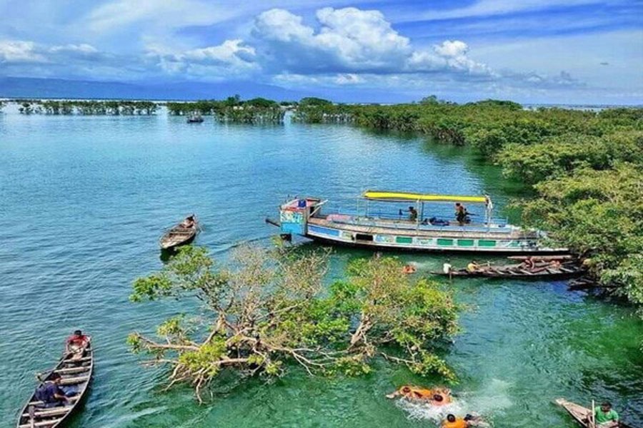
After the start of the recession of water from the country's 423 small, mid-size and large 'haors', people living around them await some new spectacles. A couple of months ago, the bowl-shaped and rainwater-filled depressions gave the look, outwardly, of mini-seas. With the approach of the dry seasons, especially of winter, they are set to offer their views as seemingly endless patches of grassy land --- punctuated by lush green or golden patches of croplands. This year is no exception. Winter is the perfect time for the 'haor lands' wearing a typical brownish look due their being in harvest time, particularly of different varieties of paddy. These distinctive views have been emerging in accordance with the seasonal cycle for ages. In short, there are two distinctive faces of the Bangladesh 'haors'.
'Haors' are scientifically called 'wetland ecosystems'. Those of Bangladesh have been merged with the country's ecology since the land's early formation. The haors, basically wetlands, stand out with their typical features in both the monsoon-dominant, and the dry winter seasons. These two phases offer the people living in villages encircling them both gifts and blights of nature. During the long monsoon, the haors assume the shapes of vast water bodies. Some village-clusters fall in the middle of a large haor. Veritably, they offer the look of small islands. Their communication with the nearby villages gets disrupted. Travel to the nearby health complexes, hospitals or educational institutions turn out to be unbearably gruelling experiences. Deaths by drowning while on boat trips, robbery and other crimes become dominant. Compared to the dry seasons, the monsoon appears with all its dreadful features.
With the average number of people unacquainted with the haors' dry phases, their monsoon shapes have been made to be known as synonymous with typical haors. The very idea of a haor brings to mind the visual of a water body full to the brim. To many, haors stand for economic inactivity, a time of crushing depression and poverty, and loss of earning sources. According to sections of rural socio-economic experts, the economic stalemate prompted by the water-filled haors leaves a considerably noticeable impact on the country's overall growth. The only exception in this economic doldrums is seen being made by the haor-based fishing sector. But their contribution to the national economy is tiny.
With the summer-time parched haors offering another raft of woes and adversities, especially in the area of communications, the semi-primitive haors remain in Bangladesh as a great impediment to progress. But due to their omnipresence in vast swathes of the country, the government cannot deal with the haor-based woes overnight. In short, the haors pose a challenge to a region's progress. Even their awe-inspiring beauty cannot draw the domestic and regional tourists in the numbers which is seen in the neighbouring countries. To speak plainly, it's the lack of modern communication infrastructure and related amenities which keep the tourists at bay.
On the other hand, the haor's dry-season farmers remain deprived of the safe communication facilities to take their produce to the nearby markets and ports. Against this backdrop, the government plan to construct an 11-kilometre elevated road across the haors in the Kishoreganj area is undoubtedly a welcome project. Though set to be built in Kishoreganj, it is aimed to connect the north-eastern haor areas with the rest of the country. Policymakers involved with the grand, innovative project have in mind the imperative of helping the haor areas' farmers market their agricultural products by using the elevated roads. Moreover, the elevated roads are set to attract tourists to the large haors located in the northeastern region. The districts include Sunamganj and Netrokona in the main.
However, some low-lying stretches in the Brahmanbaria district turn into virtual haors in the rainy season every year. Those areas are also badly in need of elevated roads above their haors. According to the plan, a 10.8km elevated road and a 97.86km all-season upazila road are set to be in operation under the project. Experts and stakeholders eagerly look forward to the project. As they view it, after the completion of the project, the physical infrastructure development in the haor areas will see facilitation in easy transport of goods like ago-products and fish resources throughout the year.
The government agencies concerned are mulling construction of six to seven two-storey towers on both sides of the elevated road to offer tourists a chance to enjoy the aerial beauty of the vast haors.
The river-filled Bangladesh has numerous large and small haors. The larger of them include Hakaluki, considered one of Asia's largest marsh wetlands,Sumir, Tanguar, Dakhar, Kawadighi, Mukhar etc. A haor is physically a vast natural container, and a bowl or saucer-shaped shallow depression. It is also defined as a back-swamp.
During monsoon, haors receive surface run-off water from rivers and canals to become vast stretches of often-turbulent water. In English, a haor is called a 'marshy wetland ecosystem'. Apart from Bangladesh, haors are found in Canada, Russia, Botswana, Peru and a few other countries.
Both highly developed and middle-income countries try their best to make optimal use of their wetlands thanks to the water bodies' extraordinary features. For reaching Kansai Airport on an island in Japan, they have built a subway through the sea. Bangladesh's humble attempts to construct elevated roads to travel between haors are also no pipedream. It's achievable.


